- 55.6 Miles Cycles
- 4005 ft of Climbing
After a great night’s sleep in Bodmin, I packed my bike up and headed off on Day 2 of MyLejog. I have to say that the Airbnb was superb waking up rested and opening the curtains to a bright sunny day was an added bonus.
Cycling the Camel Trail on Day 2 of Lands End to John O’Groats Ride
I set off from Bodmin and headed towards the Camel Trail, I have ridden a little bit of this at the Padstow side and was looking forward to cycling more of it. I joined the trail at Bodmin, turned right and I followed the path. Gradually climbing up the Camel valley the off-road route gave glimpses of the old railway line that it used to be. Old platforms, railway relics, and the odd bit of old track were visible along the route.


It was a very enjoyable couple of hours as I took my time gently pedaling. The weather was much improved compared to the day before and the often tree-lined trail gave me shade on a sunny morning. As the Camel Trail comes to an end at the hamlet of Wenford Bridge I stopped for a coffee at the Snail’s Pace Café. A great little café stop to refuel, with the added bonus of a bike shop and toilets.
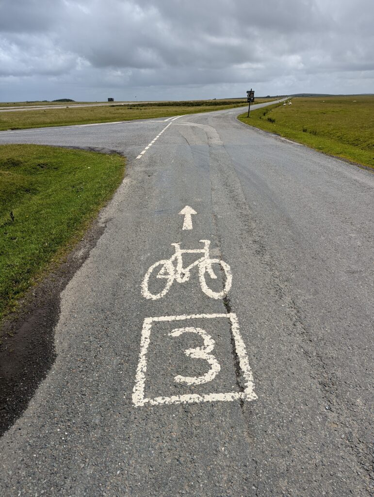
At the end of the Camel Trail, the route joins the road that leads up to Bodmin Moor passing through the villages of Row and Churchtown following NCN Route 3. The next few miles were the longest hill of the ride so far as I climbed up to the edge of Bodmin Moor. A warm sunny morning made it that little bit harder however I was soon up and out of the Camel Valley and looking out across Bodmin Moor.
Cycling LEJOG Along NCN Route 3 on Bodmin Moor
The road up on to Bodmin Moor is steep at times, you can see the North Coast of Cornwall to your left and the Moor to your right. After climbing for a few miles I approached this cattle grid which seemed to be the entrance to the moor. On this occasion and every other on the ride I always took the gate option. Open countryside and breathtaking views awaited me, and a strong tailwind pushed me a long at speed. It was virtually traffic free and a joy to cycle.


I rode through a ford, passed a wind farm and eventually saw a sign for Stannon Stone Circle. Situated about a mile off the route, I went to take a look. The stone circle is close to St Breward on Bodmin Moor, a large circle o 47 stones dating back as early as the Bronze Age. It was a peaceful few minutes as I enjoyed the view of Rough Tor, Brown Willy, and King Arthur’s Hall in the distance. Conscious of time and the journey ahead I set off again to meet yet another surprise.
Cycling up the old Runway at RAF Davidstow Moor
The Easy East Coaster route that I was following mentioned an old RAF Airfield. I approached the old airfield to be greeted by a lot of security guarding the place. Reading up this was due to a multi-day rave held at the site only days before. RAF Davidstow Moor is a deserted airfield that closed in 1945. With three runways it has since been used as a racing circuit in the 1950s and is now used by Davidstow Flying Club. I could not resist a cycle up the runway, a huge concrete expanse complete with potholes. This was my downfall, I noticed the old control tower and went to take a look. I hit a bump and my pannier rack collapsed which meant I was in trouble. One of the bolts had worked loose and after 20 min or so

of trying to find it, I had to improvise. A car stopped to help but I told them I was OK.
Another cyclist stopped to offer assistance. I used two cable ties (glad a brought them in my tool kit) to secure the pannier and the cyclist gave me two spares. This temporary fix lasted only 5 minutes and again I was limping along. The pannier was rubbing on my wheel, along the flat it was hard work but eventually, the route started the descent off Bodmin Moor.
As I started the descent I hatched a plan to seek help from one of the few farms or houses in the area. All I needed was a bolt and I came across a house after a mile or so. The house had a large garage with an open door. In the garage, I could see a multitude of old lawnmowers and machinery.
I stopped at the gate and was met by an angry Jack Russell dog, not wanting to go further I shouted. Eventually, an elderly gentleman appeared. I explained my situation and he headed off into the shed, a minute later he appeared with an M5 bolt. A swift adjustment and I was back on the road again, that man saved my day!
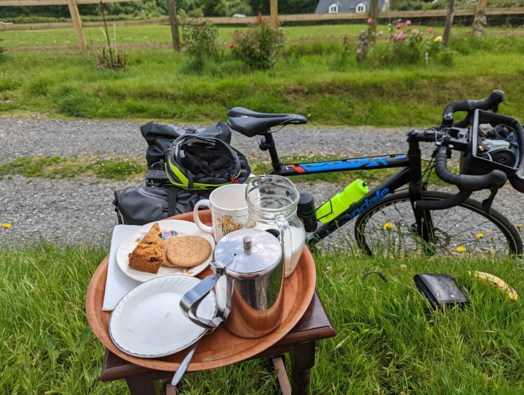
After cycling a few more miles along quiet country lanes it dawned on me that I did not have much food with me and I still had a way to travel. Getting hungry I could see on the map that my options were limited. Then as I entered a small village called Pipers Pool, I noticed an old lady adjusting a sign that read Snacks, Teas, and Coffee. I stopped and had an excellent afternoon tea, cake, and biscuits, a welcome stop after the earlier stress.
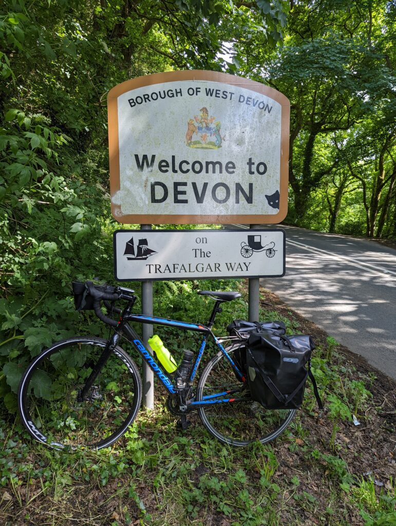
The route then took me via some really good, quiet back roads to the town of Launceston where a refuel at the COOP was in order. The next few miles saw me cycling on slightly busier roads and I passed over the Devon border. I had made it out of Cornwall virtually unscathed, a great feeling. I reached Sprytown where the road headed off onto country lanes again. The second large climb of the day took me towards Lydford and onto the Granite Way. Lydford is a lovely village that I have visited before, the remnants of a scarecrow competition were visible in the village and I took a moment to take in the surroundings as well as enjoying the relief of not having to cycle up and down steep Lydford Gorge.
LEJOG Day 2, Cycling along the Granite Way
I had cycled the Granite Way 2 years before, that time with my family so I was looking forward to revisiting the familiar cycle trail. With Dartmoor to my right, I set off for the last few miles of the day with Oakhampton as my destination.
The Granite Way is an off-road cycle route that is mainly smooth tarmac apart of s short stretch. An old railway line that is littered with reminders of its history as a busy transport route. Part of NCN Route 27 the trail also takes in a couple of high bridges, one of which is the Meldon Viaduct. After cycling over the viaduct I then made my way off the trail to my bed for the evening, the Betty Cottles Inn on the edge of Oakhampton. The Betty Cottles Inn was cheap, at only £35 per night it was good value. The cycle storage was an old shed in the car park which I was nervous about.

The place is huge, a massive restaurant and bar area but the place was deserted. Only a handful of customers in what was once a bustling inn. I met two fellow LEJOG’ers, a farther and son at the end of their day 1. It was a cheap and cheerful place to stay on the edge of Dartmoor, I just wish I had brought my earplugs as the road outside was noisy in the night.
After a few drinks and some food, I settled in for the night after a very successful day 2 of My LEJOG.